Twin Barns & Twin Terrifying 25s Part 1 – Hiking Mt Morgan and Percival
Hiking Mt Morgan & Percival in the Lakes Region, NH
- Region: Lakes Region, NH
- Difficulty: Hard
- Length: 5.2 miles
- Elevation: 2,220
- Elevation Gain: 1,492 feet
- Trail Map: AllTrails
- Website: Squam Lakes Association
Peakbagging on a Spring’s Day
On May 15th, we continued our quest to hike all of New Hampshire’s 52 peaks with a view (WAV) with a trip to the Lakes Region to summit both Mt Morgan and Percival.
To make things even more exciting, we also planned to mark off two of the trails on the Terrifying 25 – the ladder route up Mt Morgan and the cave route down Mt Percival. The Terrifying 25 is a list of the 25 most white-knuckle trails with fear inducing sections of technical hiking. As someone who has already tackled the Beaver Brook Trail up Moosilauke and the Kings Ravine Trail up Mt Adams, I was game.
The Ladders up Mt Morgan
We arrive a bit later at the trailhead than we normally do at 9:30 am – such luxury, right. Thankfully there was still plenty of parking. Good to note that the trails are closed during “mud season” to help preserve the integrity of the paths up the mountain. If you’re planning a Spring hike, be sure to double check the Squam Lake Association’s website for restrictions.
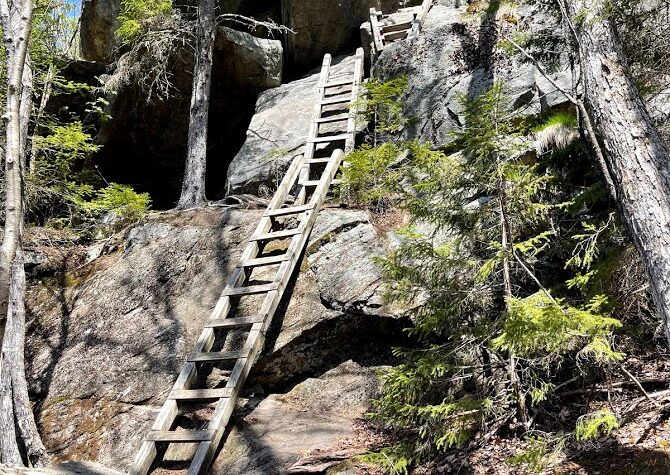
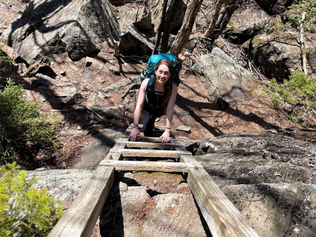
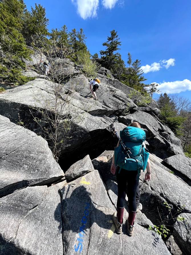
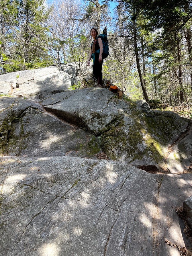
The first mile and a half was a pleasant walk in the woods with a fairly wide trail that gradually increased in elevation. It wasn’t long until we reached the famed ladder of the Mt Morgan Trail, which marked the steep final ascent.
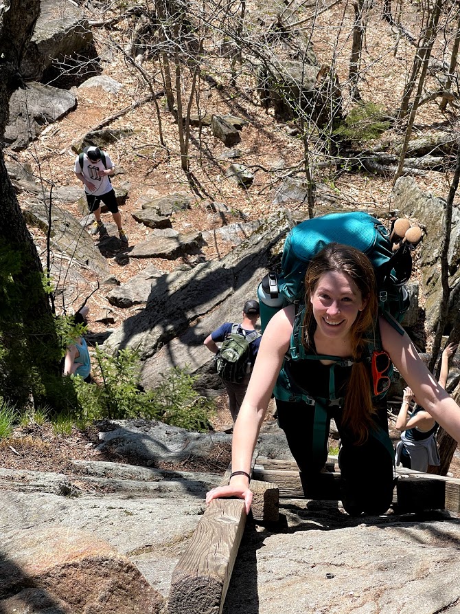
If you’re an avid hiker of the White Mountains, ladders are a common place, but what puts this trail on the Terrifying 25 list, is having to switch between ladders near the top of a cliff without anything to save your fall off the 20 foot drop. While most able bodied individuals are able to accomplish this feat with ease, there is still the chance of one misplacing your foot and tumbling 20 feet onto rock and spruce trees.
The best part is that immediately after the ladder there is a small boulder cave. This trail can be described as super fun. After the cave, you’re scrambling up bald rock faces the rest of the way to the top. This section too is also tricky, with some steep drops just off to the side.
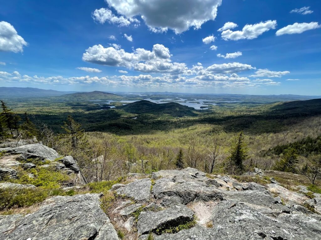
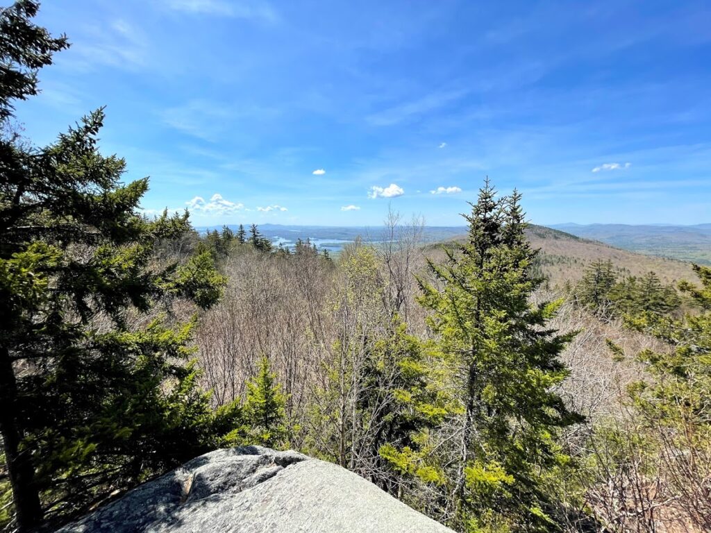
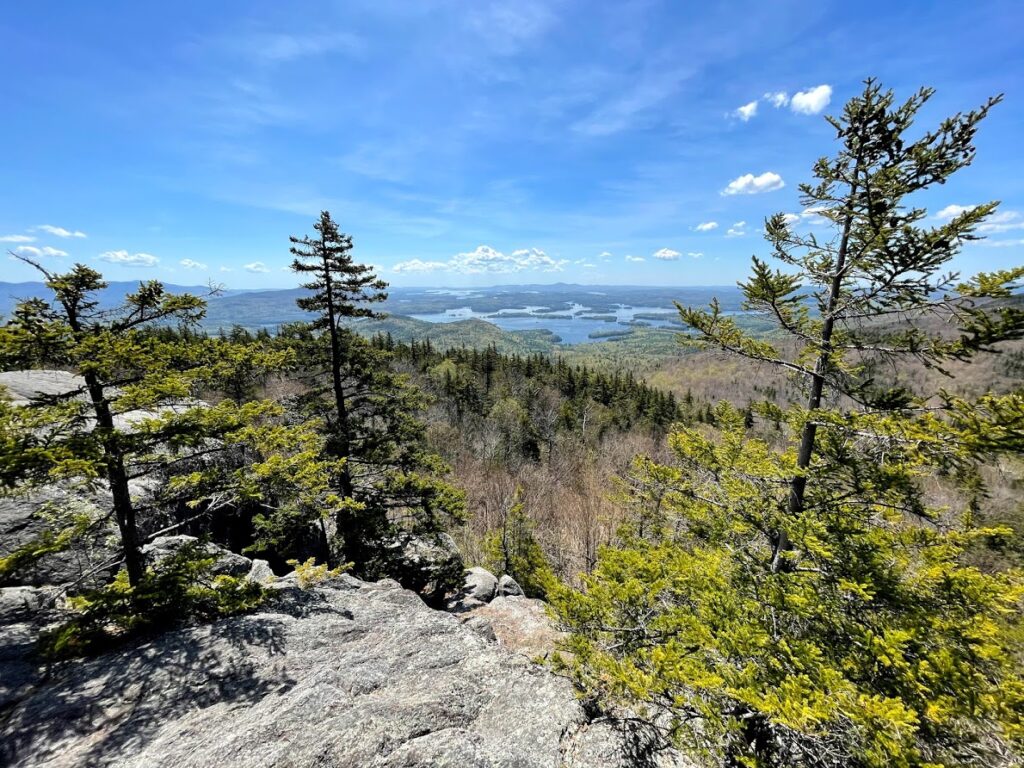
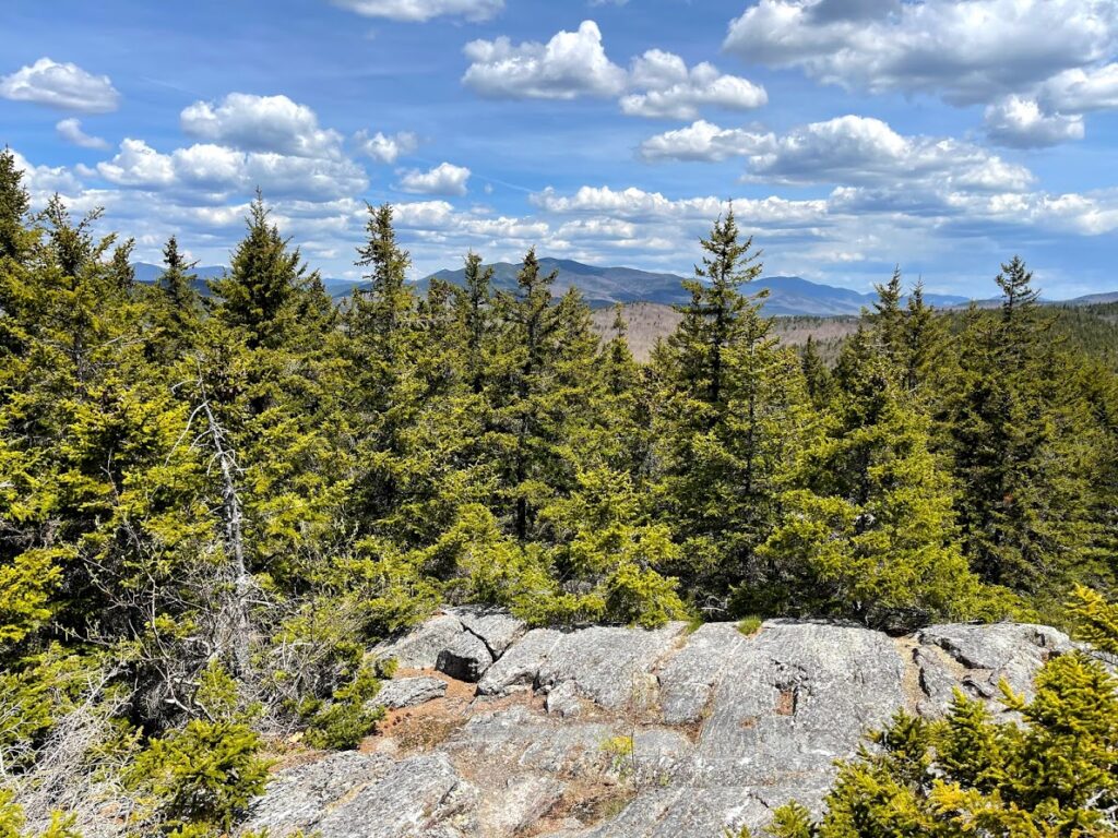
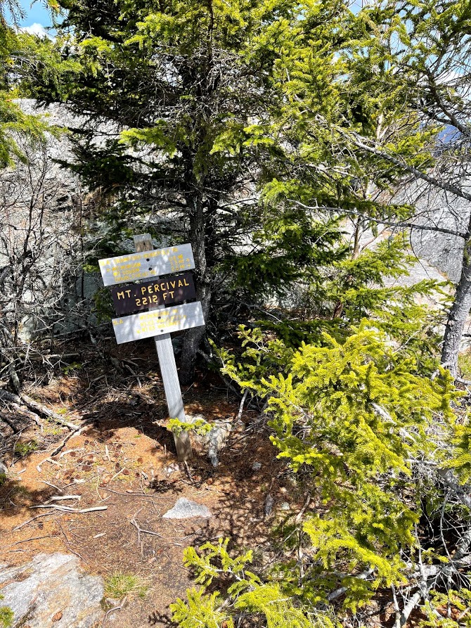
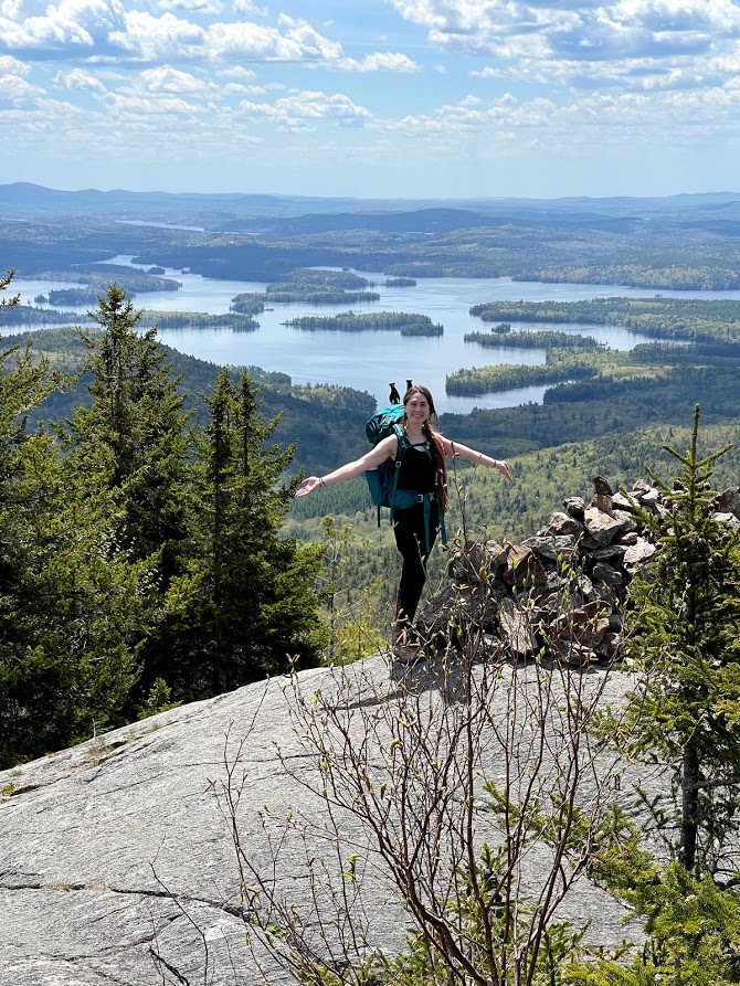
Soon after, we made it to the peak where we could mark off our first 52 with-a-view and first Terrifying 25 for the day. At the summit, we were greeted with a commanding view of Lake Winnipesaukee in all of its grandeur as well as the Rattlesnake Mountains.
We stopped for a quick snack of ice cream sandwiches and were off to our second peak. Good to note, that this is a fairly short hike and ice cream sandwiches will travel well in a simple metal thermos thrown in the freezer the night before.
Off to Mt Percival
The route to Mt Percival – or as I like to call it Percy – is just 0.7 miles from the peak of Mt Morgan. The trail connecting the mountain is fairly flat with a few rock scrambles thrown in for good measure. If you already tackled the ladder, this will be a cake walk.
It wasn’t long before we made it to the summit of Mt Percy and were greeted with an even better view of Lake Winnipesaukee to the South and even the Sandwich Range of the White Mountains to the North.
We stopped here for a proper lunch and a beer as we gazed out at New Hampshire’s largest lake in the near distance.
Into the Caves of the Mt Percival Trail
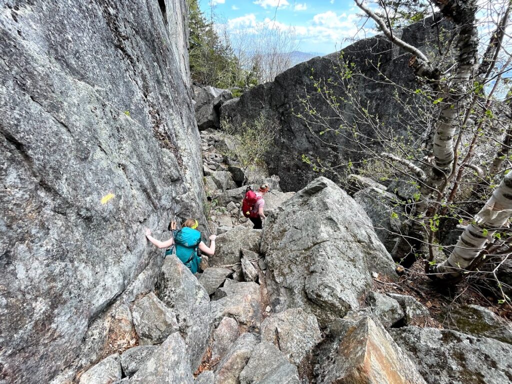
We finished our lunch and started our descent. The trail was gorgeous, but seriously no joke. We followed a cliff mostly consisting of uneven boulders as we carefully made our way down. The views were gorgeous, but the immediate drop to our right was ever in the back of our minds.
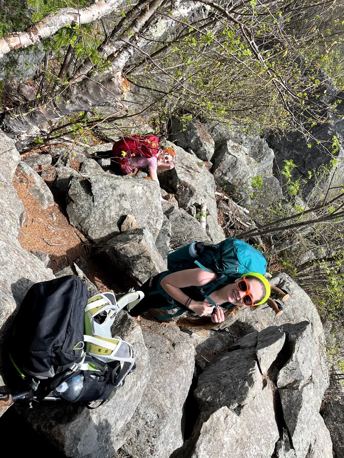
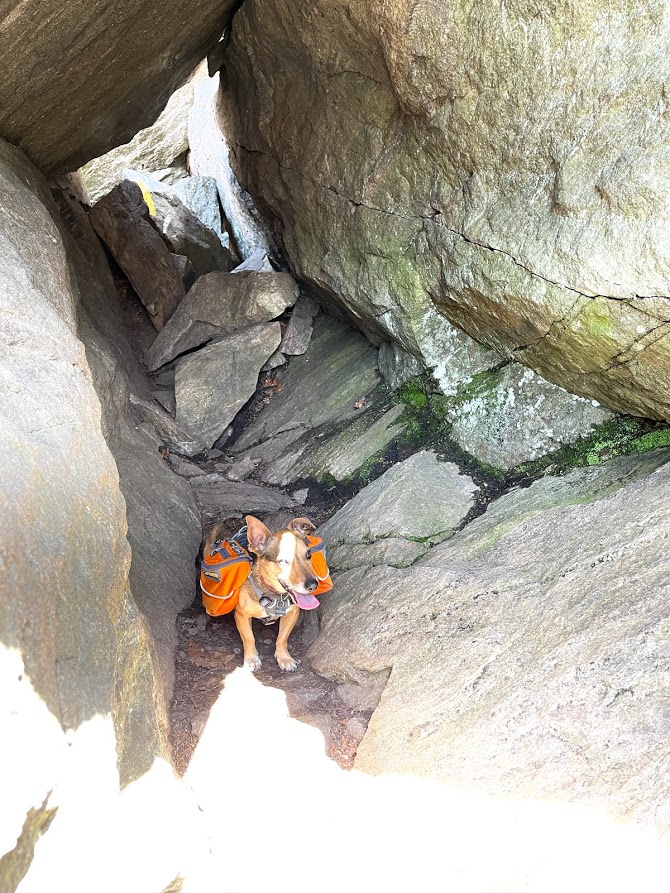
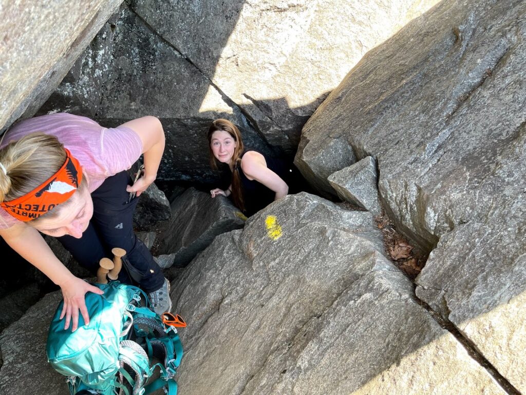
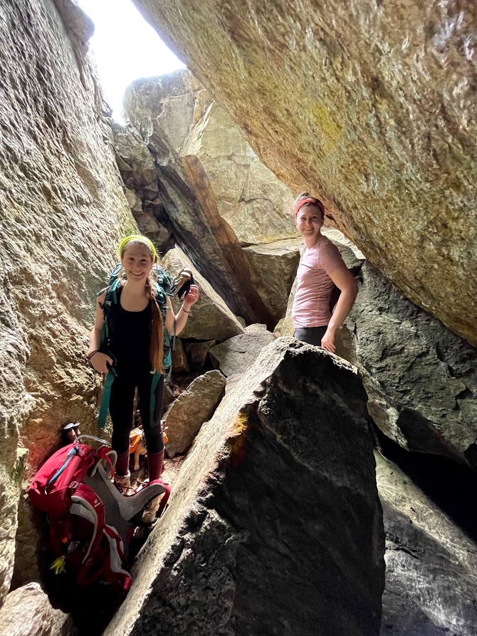
Soon we encountered our first cave, which would be easy to miss if there was nowhere else to go. Essentially we had to carefully lower ourselves into the cave that was extremely narrow. If you’re afraid of small spaces or are on the larger side, this trail likely isn’t for you. Thankfully there is an easier alternative trail if you so choose.
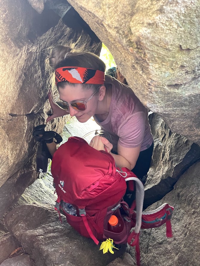
The cool factor about this trail is that once you’re in the boulder cave, there’s a small chamber before you climb out the second opening.
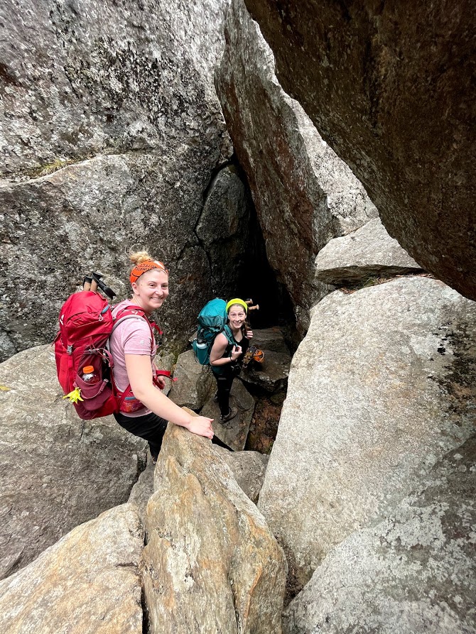
We make our exit from the chamber, careful not to scratch ourselves in the tight rock opening and passing our packs between each other.
On the other side there was some bouldering, but nothing as difficult as what we had just done. After a fairly steep descent, we were back on gradual ground for the remaining 2 miles back to the trailhead.
Twin Peaks, Twin Trails, Twin Barns
We made it back to the car after the remainder of the trail being a walk in the woods. Overall, this was an extremely fun route with many features – like boulder caves – you don’t normally see on trails. While it is a short hike, it is very technical. However, most able bodied adults and children should be able to complete the loop – in dry conditions – without issue.
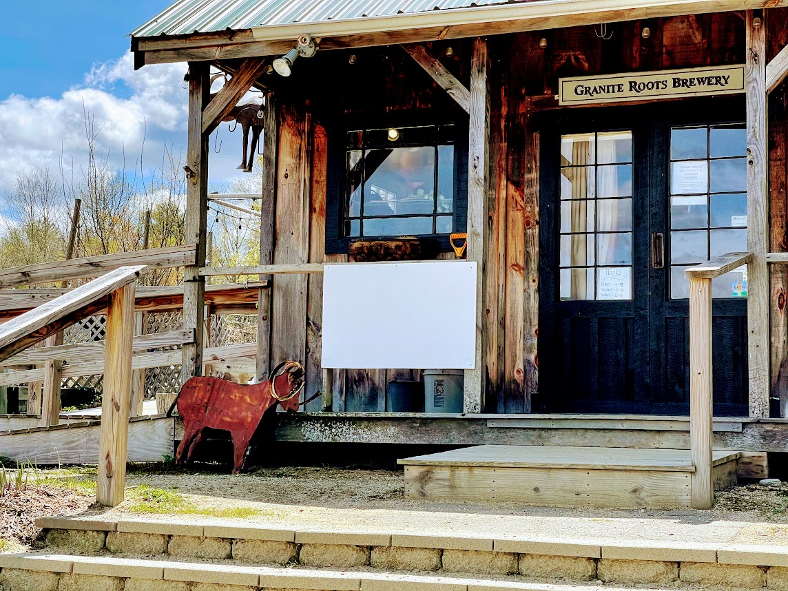
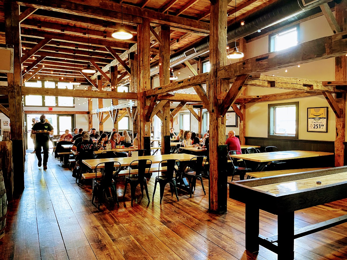
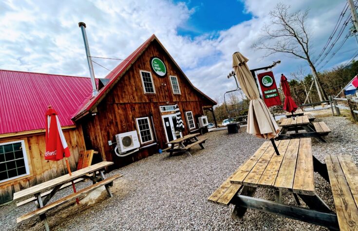
After our hike, we decided to head to Twin Barns Brewing in Meredith, NH in celebration. Read about our experience at the brewery in part 2 of this post.
Brad Brad
The Last Chair Up Mt Cube
It is Mid-Spring, which means the awkward season between ice and mud in the White Mountains. Trying to avoid the mud and soft slushy snow of higher elevations, we elected to climb...
Castles in the Clouds Part 1: Hiking Mount Roberts & Shaw
On a hot and humid day in late May with the threat of an afternoon rain shower, we arrived at Castle in the Clouds in Moultonborough, NH. Situated on the slopes of a mountain overlooking...